

WHAT IS S3AM?
The S3AM aquatic drone and monitoring technology provides on-bottom oyster data and technology to bring bottom farming and cultivation of shellfish into the 21st century, resulting in better oysters and a healthier overall benthic environment.
Use of the S3AM aquatic drone technology will provide fast, effective assessment of sub-tidal lands for profitable lease development, precision seed planting on bottom, determining inventory population and size during growth, and harvesting 100% of the crop.
S3AM technology involves two elements: monitoring and harvesting.
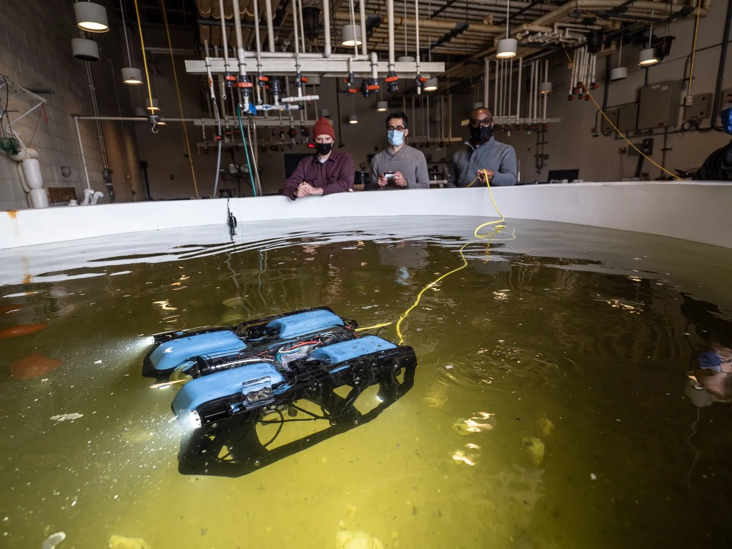
About S3AM technology

Camera and sonar sensors will be combined to create a comprehensive imaging system to detect oysters on the seafloor. One set of forward-facing sensors will be used for underwater drone navigation and imaging. An additional downward-facing camera and sonar combo will be used to create a real-time oyster crop inventory map.
In case of murky conditions, the drone will also be equipped with a set of broadband white LEDs and narrowband yellow LEDs for underwater penetration. Sonar sensors can also help in low visibility waters.
S3AM monitoring
The S3AM underwater drone will provide a multi-level mapping process to create a comprehensive map of the bottom that can accurately guide oyster cultivators.

Oyster inventory map: In order to identify live oysters in a variety of sizes, shapes and colors that represent different coastal regions, the S3AM underwater drone will be sent to the East Coast, West Coast and Gulf Coast to collect a large amount of images of oysters in different habitats and weather conditions. These images will be combined into a high-resolution map detailing oyster distribution in each region using image mosaicing, for use in oyster detection and quantity.
Navigation map: A smart-dredging process is created by combining the crop inventory map, GPS data, and water current estimation algorithm. The dredge is precisely positioned through the use of a mini-sonar emitter mounted on the dredge, three sonar receivers mounted under the boat, and a set of sensors placed on the dredge crane. The dredge position information is used together with the crop inventory map to create an optimized dredge harvesting path. This path helps maximize the harvest of market-size crops while avoiding rocks and mud to reduce fuel consumption and labor costs.
Environmental map: In order to combine the collected data into an intuitive, legible map, the S3AM approach provides an environmental data “learning model” for the drone software that enables self-calibration. Once correctly calibrated, maps will be produced that focus on a specific area, capturing different environmental measurements like temperature, dissolved oxygen, light penetration, turbidity, and salinity.
Over time, this collated environmental map will create realistic environmental predictions for a specific aquaculture site.
S3AM Smart Precision Harvesting

HARVESTER USING S3AM MAPPING TO INCREASE EFFICIENCY
For efficient, organized oyster harvesting, the S3AM software will combine a crop inventory map, precise dredge position, and current water estimations to create an optimal dredging boat path, saving time and labor, and increasing efficiency.